Our Work
Our Projects
Asia Pacific Surveys is an elite group of consultants offering wide experience in all aspects of surveying, mapping GIS, land tenure and property development specialising in the south west Asia Pacific Markets.
- Mining Projects
- Site & Detail Surveys
- Planning, Subdivision and Cadastral Projects
- Mapping, Geographic Information Systems and Computing
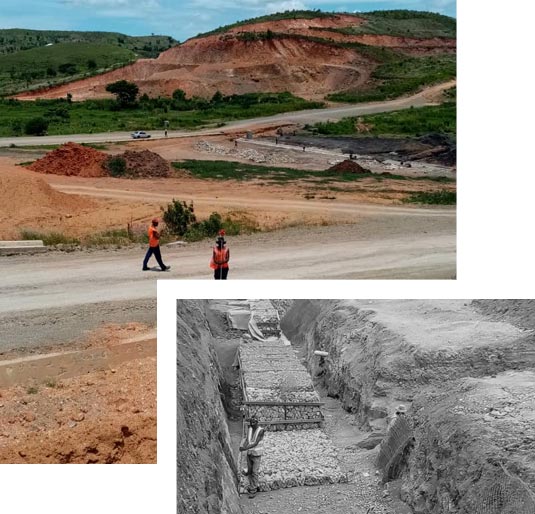
Projects - Site & Detail Survey
PNG LNG Project – Port Moresby Technical College Survey
Client: ExxonMobil
Date: January 2009 – Ongoing
Topographic & Cadastral Surveys, Quality Control Surveys of construction set-out, and as built surveys for the construction of a new training facility for the PNG LNG Project.
PNG LNG Project – Downstream Works
Client: ExxonMobil
Date: March – December 2008
Topographic Survey of the proposed plant site & 16 km of road leading to the site. GPS Control surveys. Cadastral Survey of SP152 (approx 4,500ha) and creation of on shore and off shore leases for the LNG facility.
PNG Gas Feed Project
Client: ExxonMobil
Date: May – October 2005
Topographic surveys for the FEED component of the PNG to Gladstone Gas pipeline, based in the remote gulf region of Papua New Guinea. Also involved setting up of a large geodetic control network for the entire site using GPS technology.
Transport
Kookaburra Street Overpass
Client: Hawkins Infrastructure
Date: June – October 2013
Control and detail surveys for the Kookaburra Street Overpass over the Hubert Murray Highway, Port Moresby. Total length 2.2km and maximum height 5.5m.
Gerehu Roads Project
Client: Curtain Brothers (PNG) Pty Ltd & National Capital District Commission.
Date: 1995 and 1998
On-site surveyors responsible for construction set-out, calculations and data processing for the freeway linking the airport to Port Moresby CBD. Also responsible for As-Built surveys and establishing a GIS database of the As-Built Data.
Lae Roads Upgrade
Client: Department of Works
Date: October 1994 – January 1995
18 km section of topographic survey for the upgrade of local roads.
PNG Airports Redevelopment
Client: Sinclair Knight Merz and SMEC International
Date: 1997 and 2001
Topographical surveys of the Madang, Kavieng, Momote, Vanimo, Nadzab, Mt Hagen, Tokua and Hoskins aerodomes. The survey formed the basis for the engineering design for the reconstruction of these aerodromes.
Jackson Airport Upgrading, Port Moresby
Client: Cardno and Davies
Date: March – November 1997
As-Built surveys for the new International and Domestic Terminals, control tower and associated infrastructure.
Mining
Wia Wia Control Surveys
Client: Interoil Australia Pty Ltd
Date: October 2005 – May 2006
GPS Control surveys for seismic exploration purposes, and as built survey of existing wells.
Morobe Gold Project Feasibility Study, Morobe Province
Client: Morobe Consolidated Goldfields Limited and Harmony Gold
Date: March 2000 – 2009
GPS control, aerial mapping and topographical surveys, associated computing and resources for the feasibility study.
Ramu Nickel Project, Madang Province
Client: Ramu Nickel Limited
Date: September 1997 – 2000
GPS Control, aerial photographic control, mining lease and topographical surveys, computing and resources for the feasibility study.
Lihir Gold Mine Construction
Client: Davy Kinhill Fluor Daniel Joint Venture
Date: August 1995 – July 1997
Quality Control surveys for the construction phase, including construction set-out, as-built surveys, quantities monitoring, the establishment of Kunaye airport and topographic surveys.
Porgera Gold Mine Construction
Client: Porgera Joint Venture
Date: June/July 1995
On-site surveyors responsible for quality assurance monitoring of the construction set-out for the new plant site.
Urban Development
Rabaul Restoration Project, Rabaul
Client: Gazelle Restoration Authority
Date: 1996 – 2002
Responsible for managing survey related issues, including calculations of residential allotments for new communities, dealing with Customary Land issues, and preparation of survey plans. Also, preparation & implementation of the Rabaul mapping, subsidence and geographic information system commission after destruction by volcanic eruptions.
Clifton Resettlement Subdivision, East New Britain
Client: Gazelle Restoration Authority
Date: 1996 – 2000
Control, topographic and cadastral field surveys and subsequent data reduction and processing as well as the cadastral plan preparation and subsequent lodgment for examination and registration for the 450 allotment resettlement program.
Papua New Guinea Projects (others)
- Wia Wia Control Survey. GPS control surveys for seismic exploration purposes, and GPS build survey of existing wells for Interoil Aust Pty Ltd.
- Survey contract for the Simberi Mining Project for Nord Resources and now Allied Gold incorporating all the survey requirements for the exploration, feasibility study in New Ireland Province.
- Survey contract for the Frieda River Mining Project for Highlands Pacific Ltd incorporating all the survey requirements for the exploration, feasibility study in West Sepik Province.
- Survey contract for the Hidden Valley Mining Project for Harmony Gold incorporating all the survey requirements for the exploration, feasibility study, and preliminary engineering design in Morobe Province. Survey contract for the Morobe Gold Project for Morobe Consolidated Goldfields Limited (Abelle and now Harmony) incorporating all of the survey requirements for the exploration, feasibility study, and preliminary engineering design in Morobe Province.
- Survey contract for the Ramu Nickel Project for Ramu Nickel Limited (Highlands Pacific) incorporating all of the survey requirements for the feasibility study, preliminary engineering design and mining lease applications and surveys in Madang Province.
- Survey contract for Davy Kinhill Fluor Daniel for the supervision of all construction of the Lihir Island Gold Mine, New Ireland.
- Survey contract for the Wafi Mining Project incorporation all the survey requirements for the exploration, feasibility study in West Sepik Province.
- Titigo High School Site Survey Project incorporating the topographic survey, digital data preparation and plan production for 328-hectare land in the New Ireland Province for Department of Works.
- Kotna to Banz Road Upgrading Project incorporating the topographic survey, digital data preparation and plan production for 32km of rural road in the Western Highlands Province for Department of Works.
- Wabag to Laiagam Road Upgrading Project in Enga Province incorporating the topographic survey of 46km of existing rural roads. Kundiawa to Gumine Road Upgrading Project including the topographic survey, data processing, digital terrain model and plan preparation for 45km of road for Department of Works.
- NCD water supply project for JCRT incorporating detail survey and preparing plan and section drawing.
- Various bridge site surveys for the Department of Works and Implementation. The bridge site surveys included establishment of stable control; topographic surveys of the riverbed, banks and flood plains; topographic survey of the road approaches and bridge structure; reduction of survey data and preparation of a digital terrain model as well as topographic and sectional plans for Department of Works.
- Detail surveys and preparation of digital terrain model in National Capital District for NCDC which including: Gerehu Roads Rehabilitation; Hubert Murray Highway Upgrading; Port Moresby Town Redevelopment Project; Poreporena Highway as built; the Rainbow Estate Infrastructure; Stanley Esplanade Upgrading; Scratchley Road Upgrading; Godwit Drive Upgrading; Boroko Mall Redevelopment; Waigani Drains; and the Waigani Drive Upgrading.
- Topographic surveys for the PNG Airports Project including survey, digital data and plan preparation for the Tokua, Momote, Madang, Wewak, Kavieng, Hoskins, Nadzab, Mount Hagen, Goroka and Jacksons airports.
- As-built survey for the new terminals, access, parking, taxiway and apron areas at Jacksons Airport.
- Project management, surveying and computing for 18km of urban DTM survey as part of the Lae Roads Project, Lae plus additional DTM surveys and flood surveys as required.
- Route and topographic surveys for the Ramu Nickel Project including 80km of proposed slurry pipeline route and 70km of proposed access roads as well as the sites for the mine processing facilities, pump stations, limestone quarry, accommodation areas and the wharf and harbour. Topographic surveys associated with the feasibility study for the Morobe Gold Project near Wau in Morobe Province.
- Detail survey for the design of new drainage structures in Rabaul, East New Britain following the volcanic eruptions.
- The site surveys associated with the PNG Discipline Forces Housing Scheme.
- Survey for the subdivision of 110 rural allotments at Sigut (Stage 2), as part of the East New Britain resettlement scheme for the Gazelle Restoration Authority.
- Planning and survey for the subdivision of 450 rural allotments at Clifton Plantation, as part of the East New Britain resettlement scheme for the Gazelle Restoration Authority.
- Survey for the subdivision of the 600 allotments Kenabot Subdivision adjacent to Kokopo, East New Britain for the Gazelle Restoration Authority.
- Planning and survey for the redevelopment of Section 41, Rabaul town for the development of government facilities as part of the East New Britain redevelopment for the Gazelle Restoration Authority.
- Planning and survey for the development of Paiam Town, near Porgera in Enga Province. The development includes the design and development of a commercial centre, public facilities, light industrial area as well as housing for mine personnel and the public.
- Planning, mapping and survey for the redevelopment of Kerema town and the development of Epo Plantation, near Kerema in Gulf Province. The development includes the upgrading of infrastructure in Kerema and the planning for a satellite town at Epo Plantation.
- Master plan of totally planned Integrated Residential and Commercial Community for the University of Papua New Guinea involving a population of approximately 6000 people.
- Survey and planning associated with the proposed Private Hospital and the 54 high covenant allotment subdivision adjoining Port Moresby General Hospital, Taurama.
- Master planning and survey associated with the proposed Centennial Estates development, Tokarara comprising 185ha and incorporating residential, commercial, and light industrial developments as well as public facilities such as schools, parks and entertainment areas.
- Survey and planning associated with the 25 high covenant allotment Koki Heights Residential Subdivision, Port Moresby.
- Boundary and engineering surveys for the development of Londolovit Town on Lihir Island, New Ireland. The town includes 100 residential allotments, 30 industrial allotments, single person quarters, a school, sports and entertainment areas and commercial and shopping facilities.
Special Mining Lease of 54km2 in area, one Mining Lease, eight Leases for Mining Purposes and 180km of Mining Easement surveys for the development of the Ramu Nickel Mine in Madang Province. The survey also includes the identification and marking of landowner boundaries.
Lease for Mining Purposes surveys associated with the Lihir Gold Mine in New Ireland Province. - Mining Lease survey for Misima Mines, Milne Bay to extend their mining lease.
- Customary land surveys for the Ok Tedi Mine Home Ownership Scheme.
- Customary land surveys for the development of Oil Palm allotments for Milne Bay Estates in Milne Bay Province.
- Aerial photogrammetric mapping for the Morobe Gold Project feasibility study. The aerial mapping covers an area of some 50km2 and incorporates 107 aerial photographs. Digital processing techniques have been utilised to produce rectified digital imagery, digital elevation models and contours over the project site as well as traditional orthophoto maps.
Design and preparation of a GIS for the development of Paiam Town, near Porgera. To date we have prepared the digital cadastral database and merged other existing data sets, including aerial mapping and topography information. The town planning design is presently underway. - Design and preparation of a complete infrastructure inventory of Rabaul Town, forming the map base for engineering assessment and design as part of the Rabaul Redevelopment Study.
- Aerial photogrammetric mapping of Kavieng town to form the base of a geographic information system of the town.
- Project planning and ground control to complete aerial mapping for the Ramu Nickel Project including the Special Mining Lease at Kurumbukari, the Leases for Mining Purposes and Mining lease at Bassamuk and the 140km linking pipeline and access roads.
- Aerial mapping of Kerema town, Epo Plantation and of the linking road for the redevelopment of Kerema town and the development of Epo Plantation.
- Aerial photogrammetric mapping of Clifton Plantation to prepare a base map for the development planning of some 450 rural allotments in East New Britain.
- Preparation of a photomosaic for the planning associated with the Sigut Plantation rural resettlement project in East New Britain.
- Preparation of the digital cadastral database for the new boundaries of the Poreporena Highway and conversion of the topographic survey data into a geographic database in MapInfo format.
- Preparation of a photomosaic of Port Moresby for the National Capital District Commission.
- The pilot project for the formation of a Digital Cadastral Database for Papua New Guinea.
- Preparation of a digitised Digital Cadastral Database for the Port Moresby Planning Study conducted by Wilbur Smith Associates and the National Capital District Commission.
- Consultancy to the Post and Telecommunications Corporation for the conversion of their cable locality plans into a digital Geographic Information System, as well as on-going AutoCAD training.
Training and software installations for Civilcad, AutoCAD, and MapInfo surveying, engineering and desktop mapping software as well as survey and project planning. Trainees include: –
- Department of Mining
- Oil Search (& Chevron Niugini)
- Porgera Joint Venture
- Ok Tedi Mining Limited
- Morobe Consolidated Goldfields Limited
- West New Britain Palm Oil Development
- National Capital District Commission
- Department of Transport and Civil Aviation
- Department of Works and Implementation
- Department of Lands and Physical Planning
- Telikom PNG
- National Housing Corporation
- PNG Electricity Commission
- Gulf Provincial Administration – Division of Technical Services
- New Ireland Provincial Administration
- Gazelle Restoration Authority
- East New Britain Provincial Administration
- Lae City Authority
- Morobe Provincial Administration
- Milne Bay Provisional Administration – Division of Lands and Survey
- West New Britain Provincial Administration
- Various Oil Palm Industries
- Various Consulting Surveyors, Engineers and Architects
- Consultancy to the National Capital District Commission Technical Unit, Telikom Planning Section, Milne Bay Provincial Administration and the Department of Morobe Provincial Administration to modernise their facilities. This consultancy includes the training of the surveyors, engineers, lands Officers and draftsmen in the use of the equipment and software as well as procedural training.